B sides: April 8-22, 2017

IMG_3291

Desert Sage.  JEM Trail, Hurricane, Utah.


This was Amelia’s last two-week Spring Break for the foreseeable future.  Her district is going to one week next year, like most districts.  So we kind of went big and traveled a lot of miles, maybe too many miles, over 2,200.  We did a lot more stops and things besides White Sands, Dog Canyon, and Valley of the Gods.  A single stop doesn’t really warrant its own blog.  And how many times can I actually write about Hurricane and Cortez?  Our main objective with the blog is to entertain, educate, and inform.  We also hope we are inspiring people to get out and explore the beautiful country we live in.  And lastly, to put it bluntly, our minds are shit.  We have the hardest time remembering all of our trips.  So this blog provides us with dates and details, a history of our adventures and wanderings, it also helps solving disagreements that always come up between us regarding where we’ve been and when.  🙂  This post is a summary of the two weeks.

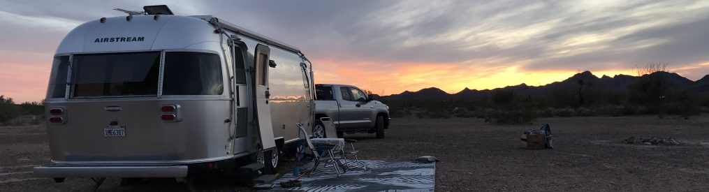
We left on Saturday April 8th.  By design our first day was going to be our longest.  We were hoping to get to a BLM boondock spot called Indian Bread Rocks, south of Bowie, Arizona off of Interstate 10.  This was the first time the Airstream had been east of Tucson on the I-10.  When we were 90 miles away from Bowie we saw the first warning sign, 80 miles ahead I-10 was closed due to high winds and zero visibility because of a dust storm.  Apparently, it’s a common occurrence.  There was a detour that routed you north and dropped you off in New Mexico.  Basically, where we wanted to go wasn’t accessible.  Good thing we had a back up plan in case we got too tired, and that was the Cochise Visitor Center in Willcox (with double ls).  And it’s a good thing it wasn’t yet dark, because the iPhone maps directions were all screwed up, but we found it.  A trippy little place that allows you to spend one night in their parking lot.  It took us nine hours.  I’m sure we’ve said this before, but that’s too long to drive and we won’t do that again.

Amelia figured out we could get free wi-fi from the visitor center, no password needed.  It was the fastest wi-fi ever, so we made the most of the situation and streamed a couple of episodes of Grace & Frankie and drank beers.  It was windy all night, and that was the beginning of me saying for the entire trip, “There’s San Diego weather, then there’s everywhere else.”


IMG_2876

Cochise Visitor Center.  Willcox, Arizona.


Our impression of New Mexico is it’s a poor, sparsely populated, beautiful state.  The population is just a little over two million, with more than half of the people living in the Albuquerque metropolitan area.  There are a lot of Indian Reservations and of course Native Americans.  In the lower half of the state we saw a lot of pistachio groves.  And roadside stands selling pinon nuts and beef jerky are a big thing.  One gas station at the north end of Albuquerque had two different beef jerky vendors set up in the parking lot!  That still strikes me as bizarre.


IMG_3688

A cool White Sands pic that somehow got left out of the post.

IMG_2995

There are 154 National Forests in the U.S. of A.  Part of Dog Canyon is in Lincoln National Forest.

IMG_3067

The not so glamorous part of glamping, dumping the tanks at Oliver Lee.


After we left Oliver Lee, the next stop was The White Ridge Bike Trails Area, aka White Mesa, outside of San Ysidro, N.M.  Many websites rank this as the number one trail in the state, all sites have it at least in the top 5.


IMG_3068

If you are ever on the 380 in New Mexico around the Carrizozo area and need a place to spend the night, the Valley of Fire National Recreation Area is a pretty sweet little campground.  We stopped to check it out and stretched our legs, then got back on the road.

IMG_3103

To get to White Mesa you have to drive through the Res, on an at times rough dirt road.

IMG_3071

What a great partnership to make this very unique place open to mountain bikers.

IMG_3073

Dragon’s Back, the first segment on the 8 mile White Mesa loop, at times it had a high pucker factor.  The wind didn’t help.

IMG_3076

Dragon’s Back was about 3 miles long, often nothing was in your peripheral vision, so that was weird.  And the wind…

IMG_3081

My wife is a mountain biker!

IMG_3089

Some really strange terrain to be riding on.

IMG_3080

It was definitely a unique ride, but if this is one of the top rides in the state, then Utah has nothing to worry about.

IMG_3098

I’m sure there are people who ride past the danger sign, but this time not us.  We started to hike a bike it, but even that was sketchy so we turned around and finished on another trail.

IMG_3069

We spent the night in the trailhead parking lot.


Up next was three nights in Cortez, Colorado.


IMG_3128

Bernie and Shawn, the two brothers that own this KOA.  They do an absolutely fantastic job running the property.

IMG_3113

If you like mountain biking, then you must go to Cortez to ride Phil’s World.  Rib Cage will blow your mind.


After Cortez was Valley of the Gods, then off to Hurricane, Utah.  Where our friend Shelli met us and stayed with us for two nights.


IMG_3263

After Valley of the Gods, the old WillowWind RV Park in Hurricane was a visual assault on our senses.

IMG_3283

If your eyesight is good enough to see those two specs, that’s Amelia and Shelli, and of course Molly’s Nipple.  I just had to include a Molly’s Nipple pic!

IMG_3750

I can’t believe that dude is wearing a Dipsea T- shirt from 1994!

IMG_3289

Prince’s Plumes.

IMG_3306

Shelli brought Sara’s boyfriend, Osborne.

IMG_3758

My girls.


After Hurricane, we went to Cathedral Gorge State Park in Panaca, Nevada for one night. For the second time this trip, the iPhone maps let us down.  It directed us to a dirt road, that may have taken us to Utah Highway 56, but 8 miles on a dirt road, that we weren’t even sure about, didn’t seem like a good idea.  So we busted out an old-fashioned paper map and corrected course.  Lesson learned, for now on double-check route with a paper map.


IMG_3310

There’s a lot of strange places in the west, but Cathedral Gorge is right up towards the top of strange.

IMG_3312

All kinds of slots, nooks, and crannies to explore.

IMG_3319

Tight.

IMG_3343

Quite strange.

IMG_3336

Sara was going bonkers exploring.

IMG_3328

Strange and beautiful.

IMG_3759

Wild horses on the side of Highway 93 in Nevada.


Then it was off to Vegas to see my dad and his wife.  We spent the night in the Airstream in front of their house, woke up at 4am and peeled rubber out-of-town.  We really do not like Vegas.

We ended up “free camping” 4 nights, KOA 3 nights, RV Park 3 nights, and 4 nights in State Parks.  We encountered wind, thunderstorms, more wind, more really strong wind, and winds that just wouldn’t quit.  More than one person was trying to tell me it’s always windy in the spring.  All I know is, there’s San Diego weather, then there’s everywhere else.

Two last things Amelia wanted me to mention:  Why is it so hard to recycle in all the states we visited?  We finally, with guilt, just started throwing the cans and bottles into the trash.  And it just felt so wrong.  Secondly, when you go into a grocery store and bring in your own reusable bags, the clerks and baggers just stare at you like you are from another planet.

I guess to a lot of people we are from another planet.


Valley of the Gods: Easter 2017

IMG_3137

This ain’t the Walmart in Hurricane Utah, like Easter 2014!


With the advent of social media nothing is a secret anymore.  The days of a friend telling a friend about a secret spot, you feeling special because you are now in the know, and holding the secret, are over.  Now someone blabs and the whole world knows.  The blogosphere is going nuts about Valley of the Gods.  One can only hope it doesn’t get too popular.  Yet here I am blabbing about it, posting it on the blog, where it will rattle around in cyberspace for all to see.

Being on the road you run into strangers all the time, some folks are genuinely nice. Once we pulled on to the Valley of the Gods road we stopped, got out of the truck, and assessed the rutted creek crossing that every single blabber on social media is concerned about.  Sometimes it’s really bad, sometimes it isn’t.  As we were walking towards it, a guy pulling a Lance trailer was coming at us.  He was solo, stopped, and started chatting us up.

“Don’t worry, you guys can easily cross it.”

I typically let Amelia do the talking since she’s a talker, “Great, we were slightly worried. How’s the road the rest of the way?”

“A little washboardy, but I’ve been on worse.  Is your Airstream a 25 footer?”

“Yes, we love it!” says Amelia, all smiles.

“You two should take the site I just vacated.  It’s elevated a little bit so it can be windy, but the views are gorgeous.  Go 4 miles, and you’ll see it on the left.  If you get to the little Casita you’ve gone too far.”

“Wow, thanks!”

“You know, every time I see a beauty like yours I kick myself in the head for not buying an Airstream.”

What a nice guy.  And what a nice site.


Screen Shot 2017-04-18 at 7.46.03 PM

Valley of the Gods, between Bluff and Mexican Hat.  Monument Valley straddles Utah & Arizona.


IMG_3139

Front door view.

IMG_3138

Dining room view.

IMG_3131

Boondock heaven.  Free range Puggle.

IMG_3146

As I was relaxing, thinking positive, and writing down my thoughts, Amelia went on a scouting mission to take a look at what looked like a wash from our vantage point.

IMG_3162

It would be dead quiet, then we would hear the wind in the distance, a gust would come up, then absolute silence again.  Occasionally a dust devil would blow through.

IMG_3166

Amelia came back from her scouting trip and insisted we hike down to the water.  Good, because I wanted a shot like this.

IMG_3172

Lime Creek.

IMG_3177

A majestic Cottonwood.

IMG_3180

Droplets were falling from the cliffs.  The water was amazingly clear.

IMG_3722

Free ranging and hunting lizards is exhausting!

IMG_3229

Billion dollar view for free.  What a great swath of BLM land.


IMG_3201

That’s the little white Casita trailer about a half mile away.  Our closest neighbor.

IMG_3199

Monument Valley in the distance.

IMG_3217

Sunrise.

IMG_3219

Sunrise on Battleship Rock.

IMG_3242

Time to leave.

IMG_3240

The morning light was just right for seeing all the Indian Paintbrush.

IMG_3249

The worrisome creek crossing.  I know, it looks like nothing, but you have to remember Airstreams have really low clearance and aren’t really designed for off roading.

IMG_3254

Adios Valley of the Gods!

IMG_3256

Run, Forrest, run!

WildFlowers of Dog Canyon: April 11th, 2017

IMG_2935

Golden Columbine.


While visiting the White Sands we spent three nights at Oliver Lee State Park.  If this park is any indication,  New Mexico has some nice state parks.  The campground is situated at the base of the Sacramento Mountains and Dog Canyon.  The canyon is a box canyon with a fabulous hiking trail that is over 11 miles round trip with 3,100 feet elevation gain.  We only did 7.5 miles and 2,200 feet after I had the bejesus scared out of me with the closest encounter of my life with a rattlesnake.

Seeing rattlesnakes is a weekly occurrence while biking back home.  I’ve even rode directly over one that was stretched out and sunning himself on the trail.  That gave me a jolt of adrenaline.  Heck, Sara was bit by one in our backyard.

This one totally caught me by surprise.  A nice peaceful quiet trail, Amelia was yards behind me, then bam, out of nowhere the unmistakable loud hiss and rattle.  I was literally six inches away from him, for about a second, then I turned and ran like a striped ass ape down the hill.  I was scared and shaking from all the adrenaline.  The snake was scared, pissed, and sounding like a Rainbird sprinkler.  That was too up close and personal with a Black-tailed Rattlesnake for me.

My wife, she wants to keep on hiking, “Come on, it slithered into the rocks.”

“F you,” I said, “Look at me I’m still shaking!  The last time I was shaking this bad was when I skied Phillippe’s solo.”

“Come on, we can get by it.  Let’s just go around the next corner and up some more.”

“Are you kidding?  Then we have to come back down right by it again.”

“Oh my god, let’s go.”

So of course we kept hiking, eyeing the rattlesnake hissing and rattling at us as we ran past it.  We only hiked for about another half mile and decided it was time to turn around.  We were already out for about two and half hours, and promised Sara we wouldn’t be gone for longer than five hours.  Once we got to the spot above where I almost stepped on the rattlesnake, we started throwing rocks hoping to scare it off the trail in case it was sunbathing again.  We didn’t hear anything so we slowly started walking, saw the trail was clear and felt completely relieved.  “See, I told you,” says Amelia.  Then it rattled and hissed and we ran for our lives down the hill.


IMG_2938

Our site at Oliver Lee State Park.  That’s Dog Canyon behind us.  And a 90 degree back-in by Amelia!

IMG_2990

Dogweed.  Kind of a crummy “common name” for such a pretty flower.

IMG_3006

Blackfoot Daisy.

IMG_3010

Firecracker Penstemon.

IMG_3014

Indigo Feather Bush.


IMG_3019

Damianita Daisy.

IMG_3021

White Prairie Aster.

IMG_3020

Fendler’s Bladderpod.

fullsizeoutput_556

Spreading Fleabane.


IMG_3027

The second plateau on the Dog Canyon hike.

IMG_3026

Fragrant Ash.

IMG_3031

Threadleaf Phlox.

IMG_3032

Claret Cup Hedgehog Cactus.

IMG_3038

Black-tailed Rattlesnake.  Look closely, you can even see his tail.

fullsizeoutput_557

Gray Five Eyes.

IMG_2934

Puggle.

IMG_3045

Juniper Globemallow.

fullsizeoutput_555

Trailing Four O’Clock.

IMG_3051

Paleface Rose-Mallow.

IMG_3048

Rainbow Cactus.


No guarantees, but I’m pretty sure we’ve properly identified everything. 🙂

Other-worldly: White Sands National Monument

IMG_2929

Sand dunes bring out the kid in Amelia!


We knew the White Sands were white, but holy cow, they are shockingly white!  Snow blinding white.  Crazy white.  Vertigo producing white.  Other-worldly and white.  The sand is white because it’s gypsum crystals.  Even in the warmest weather you can walk barefooted on the dunes.

This is the world’s largest gypsum dunefield.  It covers 275 square miles.  The next largest is a measly 3 square miles.  The National Monument is only a small fraction because the rest belongs to the White Sands Missile Range.  Yes, they still launch and test missiles.  When they do, they actually close down the park up to three hours, as a precaution.  The world’s first atomic bomb was detonated 65 miles north of the park on July 16, 1945.  We stayed by the nearest town, Alamogordo.  While in town I was keeping my eyes open for strange looking people with deformities.  I didn’t see any, then again they are probably all dead now.


IMG_2882

What a great sign.

IMG_2904

Our first day had clouds which soften the white sands.

IMG_2910

It was breezy.  Amelia’s hair matched the wispy clouds.

IMG_2927

Just like snow shoeing downhill!  Sometimes we would sink to our knees.

IMG_2923

This gives you an idea of the vastness.

IMG_2924

No camping in the park.  They actually shut the place down at night.  But there’s plenty of room during the day for your rig.

IMG_2941

Better safe than sorry.  We don’t need some missile mishap taking out a bunch of cars on the highway.

IMG_2942

I was so inquisitive about the no alcoholic beverages date range that I tracked down a ranger to ask.  In a nutshell, they do not want the place to become a Spring Break haven for drunk college kids.

IMG_2958

Day two, middle of the day,  no clouds.  Sunglasses were an absolute must.  See that green mound right of center?  That was our goal.  It was further away than it appeared.

IMG_2969

And here it is!  A Skunkbush Sumac.  It grows dense deep roots that help form a pedestal after the dune moves on.

IMG_2972

Beautiful.

IMG_2979

In between the dunes some of the basins looked like this.  It appears to be hard and crusty but you can walk right through it barefooted no problem. 

IMG_2983

We completely lucked out and saw a Bleached Earless Lizard.

IMG_2985

Vanilla Bean Ice Cream.

IMG_2977

Purple Sand Verbena.

IMG_2987

I couldn’t help myself, but here’s the sappy last picture!

Palm Canyon Epic: April 1st, 2017

IMG_2820

Sensory overload 2017.


Palm Canyon Epic (PCE) is a true SoCal classic mountain bike ride.  The trail begins at the top of the Pines to Palms Scenic Byway (California State Route 74) at 4,400 ft elevation in the Ribbonwood/Spring Crest area and ends in Palm Springs.  It’s not a particularly long or difficult ride, 30 miles and 2,500 feet elevation gain, but you need to be fit, have better than intermediate skills, and no fear of off camber trails with sheer drops.  A good sense of humor is also a plus because invariably there’s always an incident or two.  And the incidents always add hours to the ride, which leaves you on the trail in the heat of the day with the sun sucking the moisture and energy out of your body.  In years past we’ve seen a concussion, broken wrist, cholla painfully imbedded in various body parts, slashed tires that have been unrepairable, broken chains, broken spokes, and flat tires are a given.  Oh yeah, and plenty of blood.

Naturally, the bigger the group, the higher the odds of incidents.  We try to limit the group to 5 people max.  This year was Amelia, myself, Bill, Tim, and Quan.  Bill and Tim had never met Quan.  Quan, Amelia, and I had never met Tim.  None of us had ever ridden with Tim.  And Quan and Tim had never done the ride.

Hmm… sounds like a recipe for all kinds of incidents!  Truth be told, it was just your typical PCE ride.  A slashed sidewall at 3.6 miles.  The sealant wouldn’t seal it, so we inserted a tube.  While Tim and I were doing that, the other 3 were about a half mile down the trail.  The girls got to witness Bill do a triple somersault over his handlebars.  I’m so bummed I missed that!  Thankfully he was not injured, only bloodied.  Miles further down the trail Tim was upside down like a turtle.  A few miles later his chain came off and he crashed into a cholla.  And a potential disaster was adverted towards the end of the ride when the girls noticed Quan’s rear thru axle was loose.

We unintentionally had a new finish to the ride, and it seemed like it was never going to end.  It cost us at least an hour.  If you are ever out here, avoid the Araby Trail.  It’s not the way to finish.  Everyone was out of water, dehydrated, dying from the heat, and barely holding on to their sense of humor.  When it was all said and done, we were on the trail for almost 7 hours.  About 2 hours too long.  We left home at dawn and got back at dusk.  It was a 13 hour odyssey.  What a great day!


IMG_2827

The girls at the top. One of the big time sinks is shuttling the cars.  It’s about a 90 minute round trip to drive two cars down the hill, leave the truck at the bottom, because it can carry 5 bikes, then come back up in Tim’s car.  The girls guarded all the bikes and gear at the top.

IMG_2796

Just past the start.

IMG_2794

Scarlet Locoweed.  Small and beautiful.

IMG_2797

My singlespeed is looking good here.

IMG_2843

But somewhere after the previous pic this occurred to my fork, only to be discovered the next day.  Probably a good thing I didn’t realize it during the ride.

IMG_2807

Right around here Bill did his triple somersault!

IMG_2842

And the next day, some nice identical bruises appeared on his hands from the triple somersault.

IMG_2808

There were some really lush spots.

IMG_2806

Quan.

IMG_2801

Amelia.

fullsizeoutput_54c

Blurry pic of Mallow.

IMG_2817

Miles and miles of yellow from the Brittlebush.  Riding through it was amazing.  I’m sure it’ll be one of those experiences we’ll always remember.

IMG_2829

The group.

IMG_2831

California Barrel Cactus.

IMG_2822

Wow! There are directional signs now.

IMG_2826

White-lined Sphinx Moth Caterpillars.

IMG_2823

The start of a long amazing descent.

IMG_2838

Chia.

IMG_2833

Tim pulling the Cholla needles out of his arm.

IMG_2832

Tim’s cracked phone.  He had a heck of a day.

IMG_2835

Amelia and a dude we met on the trail.  The best female and male riders on the trail that day, hands down.

IMG_2837

Storksbill.

IMG_2840

Chaparral Yucca or Our Lord’s Candle.

IMG_3642

Happy girls on the trail…it is a beautiful thing!